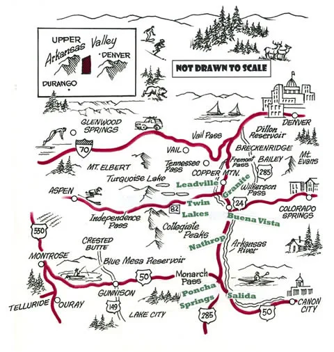
Chaffee County sits on the eastern slope of the Rocky Mountains in central Colorado. On the western front, the county is bordered by the Sawatch Range, including the 14,000-foot Continental Divide. The eastern boundary follows the Mosquito Range, descending toward the south. From high in the Upper Arkansas Valley, the Arkansas River flows through Chaffee County and the city of Salida in a southeastern direction between the two mountain ranges.
Chaffee County and Salida Colorado are at the crossroads for three interstate highways: U.S. 24, 50, and 285. Driving distances from some of the Colorado cities are as follows: from Denver, approximately 144 miles; 102 miles from Colorado Springs and Pueblo; and, 65 miles from Gunnison.
The elevation of the area ranges from just under 7,000 ft. to over 14,000 ft. on its highest peaks, providing some of the most spectacular views anywhere in the world. In fact, Chaffee County has more mountain peaks of 14,000 ft. or higher than any other county in Colorado and is often referred to as the “Fourteener” Region.
Data provided by the Salida Chamber of Commerce.